Active
Empowering island communities to reduce future flooding impacts (FloodAdapTT)
Contacts
Partners
Deltares USA, Deltares NL
Share

The FloodAdapTT project empowers island communities to better understand what risks they face from flooding under future climate scenarios and how these impacts can be reduced by employing different adaptation strategies.
Local adaptation planning for flooding requires an understanding of how adaptation strategies – such as restoring green spaces or building flood walls – can reduce direct and cascading impacts from flooding. However, island communities often lack financial and human capital to develop their own risk assessments and adaptation decision-making tools.
This project is being implemented in Trinidad and Tobago where it will enable local agencies, decision-makers and communities to use the flood risk and adaptation support system FloodAdapt, which uses state of the art modelling that can be operated by those without a modelling background.
Because FloodAdapt allows users to evaluate different future scenarios of climate change, sea level rise and socio-economic development, it is well suited to support adaptive pathways planning. It also screens a large variety of potential adaptation options to select the most promising for detailed assessment.
We will first implement the tool in two watersheds in Trinidad and Tobago: the South Oropouche River Basin and the Western Peninsula Hydrometric Unit which covers the capital city of Port of Spain and its adjoining watersheds. We will support local communities and decision-makers at the watershed and municipal levels in these areas to co-develop climate risk assessments and analyse adaptation options for cascading flooding impacts.
In the long-term, the FloodAdapTT project hopes to enable other small island communities to make concrete steps towards climate resilience by anticipating adverse impacts from climate change and sea level rise to key sectors of their economy. To this end, the project will also develop a flood modelling methodology and tool that is tailored to the needs of small islands. Accompanying manuals will be freely available.
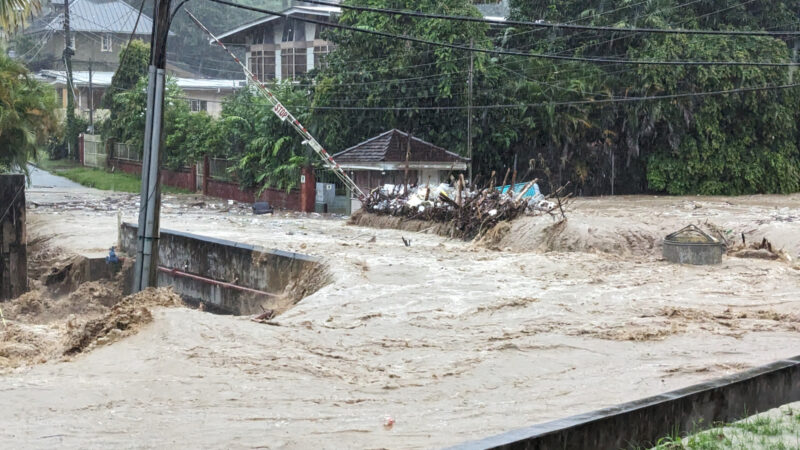
Cover image: Flood water flows along Simpson Drive by Andalucia Maraval, during heavy rains in December 2023. Credit: Sampson Nanton